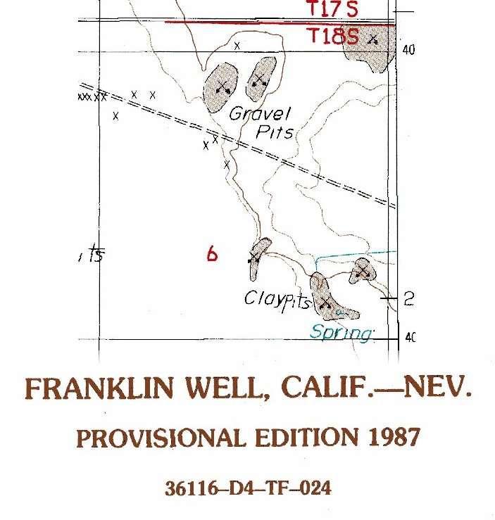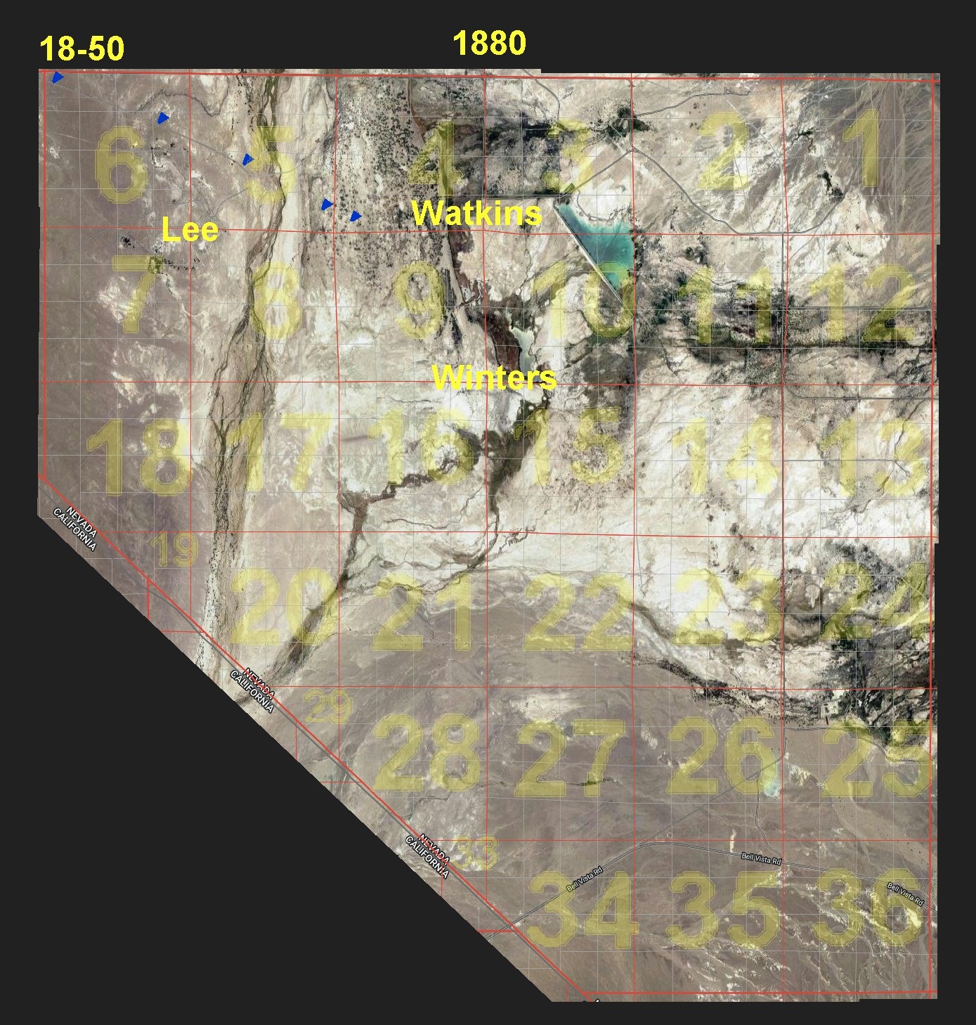
Prior to 1873 Indians were the only residences of Ash Meadows. It was Charles King who was on the Wheeler crew that survived Ash Meadows and the surrounding desert. King liked it enough to settle here in 1873 bringing with him a large heard of Cattle, and indeed gave Ash Meadows it's name. Four of the Lee Brothers were next to settle here in 1874, and King moved away after the Lees brought cattle in. Many History Books, and News Papers have recorded this much. Unfortunately the Government had a hard time finding folk that would work in the harsh desert environment for a meager Government Wage; so Bookkeeping was not always the best. Indeed there is no recording of township 18 range 50 until 1888, and it seems no one volunteered to pay their taxes except the Lees, and even they only did that once, as none of the three names from the Census are recorded otherwise. (However Winters does show up in 1886 after he bought the Pahrump Ranch.) To make matters worse, once the Recorders did start recording Ash Meadows, they were just as likely to call it Pahrump or Spring Valley, and even then the recording of township, and range remained less common. However history does tell us that Winters Ranch was out at Horseshoe Springs, which we know is in township 18 range 50, around section 14. The old road runs diagonally through township 18 range 50, but north of Winters. Fortunately Watkins still lived here in 1888 where the Assessor shows him living on sections 3 and 4, hence the north side of the road. Cran's map only tells us that Lee Spring is in township 18 range 50. But it is the Franklin Well Topo Map that leaves another clue, showing that the Clay Pit in Section 6 was once a Spring, a Spring that would be on the South side of the road, a neighbor to Winters. Lee, Watkins, and Winters. All of that to conclude that the Census Taker did indeed simply travel down the road, as normal, recording each of the three ranches. Further documentation can be found in reports from the time describing their travels from (old) Pahrump (up at the Lumber Camp), where the road ran through Johnie to Ash Meadows, through the farms, then out across the Amargosa and behind the sand dunes to the Mining District at Bald / Bare Mountains. Here is one Reporter's documenting of his travel.
